

This week, unusual-looking instruments were at work on Lihula Castle Hill and around the medieval chapel at Saastna as archaeologists explored what lies beneath the ground—without lifting a single spade.
Throughout the week, archaeological geophysicists from the Norwegian University of Science and Technology (NTNU) in Trondheim worked together with historians and archaeologists from Tallinn University to investigate Lihula Castle Hill and the surroundings of Saastna Chapel using two non-invasive survey instruments: a ground-penetrating radar (GPR) and a magnetometer.
On Thursday evening, the joint Norwegian–Estonian research team welcomed visitors to Lihula Manor, where they introduced the equipment used during the surveys and presented the first preliminary results from the investigations at Lihula Castle Hill.
“These are the very first results and still only raw data,” emphasised Carmen Cuenca-Garcia, the Norwegian member of the research team. She projected an image onto the screen showing the main building of Lihula Manor clearly visible, surrounded by a dense network of black lines. As the depth indicator on the side of the display changed, the pattern of lines gradually revealed rectangular features beneath the surface.
“You can already see structures within the area of the outer bailey, as well as elsewhere—traces of buildings,” Cuenca-Garcia explained.
“When conducting surveys like these, you have to be prepared for the worst—that the initial results may reveal nothing at all,” said archaeologist Villu Kadakas. “The fact that we already have something meaningful to show today is a very encouraging outcome.”
The magnetometer, which resembles an old-fashioned market cart with large wheels, detects disturbances in the Earth’s magnetic field caused by buried archaeological features. The ground-penetrating radar, towed behind an ATV, records differences in soil density.
“Areas containing more stones appear denser, while loose soil produces a weaker signal,” Kadakas explained, describing the basic operating principles of the GPR.
Together, these two instruments allow archaeologists to identify buried walls, hearths, and other archaeological features without excavation—features that are invisible from the surface but may be of considerable archaeological interest.
“They do not detect artefacts,” Kadakas noted.
According to Cuenca-Garcia, the instruments can investigate the subsurface to a depth of approximately one and a half metres.
“As an example, at Tarakalda in Purtse, an ancient hillfort site in northeastern Estonia, we identified the remains of burnt buildings,” said historian Kersti Markus. The surveys also revealed buried hearths, ovens, and the foundations of rectangular buildings.
“It was a remarkable discovery. Suddenly, the Viking Age and its houses appeared before us. It also changes our understanding of hillforts, because until now no one had been able to demonstrate conclusively that people actually lived inside them,” Markus explained.
Kadakas added that Estonian hillforts are generally so extensive that it is impossible to excavate them completely in order to obtain an overall picture.
The first Estonian sites investigated within the framework of this joint Norwegian–Estonian research project, supported by the Norwegian government, were Taramägi, situated at the mouth of the Purtse River, and Tarakalda, located three kilometres upstream. The project has now moved on to Lihula and Saastna.
According to Markus, the joint research project, entitled From Nidaros to Novgorod, began two years ago. The project investigates harbours and trading places along the Viking maritime route between Scandinavia and Novgorod. It is closely connected with King Olav II Haraldsson of Norway, who lived at the turn of the tenth and eleventh centuries and was later canonised as Saint Olav, as communication between Scandinavia and Novgorod became particularly intensive during his reign.
“Our broader aim was to identify important trading centres—one on Estonia’s western coast and another on the northern coast,” Markus explained.
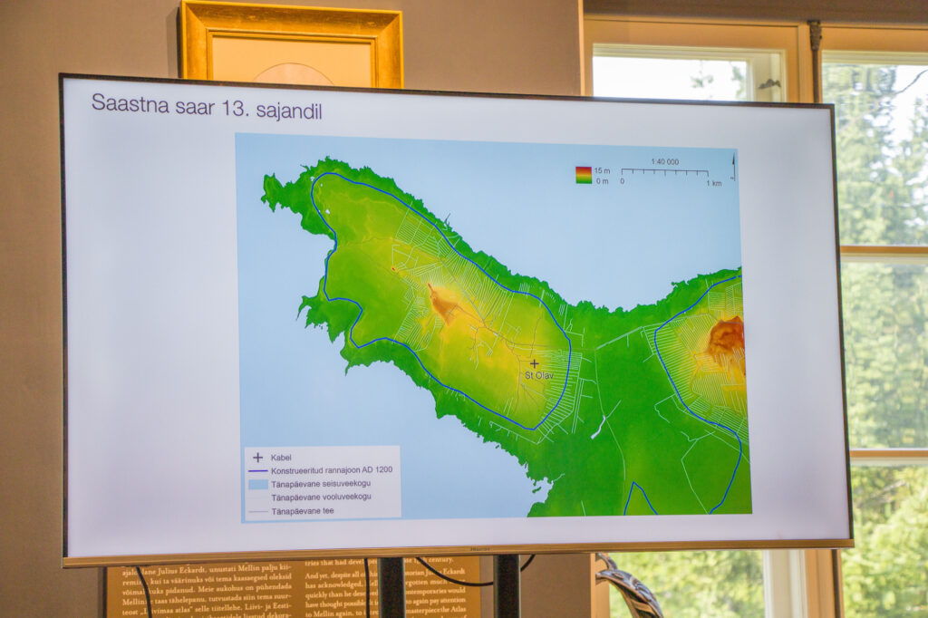
The Viking sea route passed along Estonia’s western and northern coastlines. According to Markus, churches and chapels dedicated to Saint Olav, all situated beside the water, provide further evidence of this maritime route. Saastna Chapel was one such church dedicated to Saint Olav. Archaeologists investigated the chapel last summer as part of the Norwegian project, excavating its stone walls. This year they surveyed the surrounding area with a magnetometer in order to reconstruct changes in the shoreline over time and locate the site’s former harbour.
Lihula was selected because it is the only known hillfort on Estonia’s western coast that originally stood close to the sea. All other prehistoric hillforts in Läänemaa were located farther inland.
“If we are looking for a trading centre along the western coast, Lihula is the most likely candidate. Furthermore, why was Lihula chosen as the seat of the bishopric? Episcopal centres were always centres of trade,” Markus explained.
Archaeologists have long known that the subsurface of Lihula Castle Hill contains the remains of medieval buildings, many of which have already been excavated under the direction of archaeologist Mati Mandel.
“Traditional excavations concentrate on relatively small areas, and we often have to extrapolate from those limited trenches,” explained archaeologist and Director of the Haapsalu and Läänemaa Museums, Anton Pärn. “Ground-penetrating radar and magnetometry allow us to build a much more comprehensive picture, piece by piece.”
“We hope these investigations will tell us whether any remains survive of Lihula’s earliest church and whether there is real potential to investigate what may be the oldest known Christian sacred building in Estonia,” Pärn added.
While in Lihula, the research team is not limiting its investigations to Castle Hill. Using both GPR and magnetometry, they are also surveying several other locations of archaeological interest, including the area behind the Lihula Cultural Centre, where the medieval settlement once extended, as well as the surroundings of the church and the former nunnery. Archaeologist Mati Mandel has suggested that this area may contain the graves of Swedish warriors killed by the people of Saaremaa during the capture of Lihula Castle in 1220.
Although the fieldwork at Lihula and Saastna concludes this week, the project itself is far from finished. The collected data will now undergo detailed processing in Norway.
According to Cuenca-Garcia, the raw datasets must first be cleaned and filtered. For example, the initial magnetometer image of Lihula Castle Hill reveals relatively little because modern debris and other near-surface disturbances obscure the archaeological remains.
“There is all kinds of modern material close to the surface that interferes with our ability to see the buried structures,” she explained.
Once the datasets have been processed, the results will be interpreted alongside historical maps and topographic data.
“We have already given our Norwegian colleagues a number of specific research questions that we hope these surveys will answer,” said Kadakas. “And, of course, we very much hope the results will surprise us.”
Photographs by Kaire Reiljan